Eagle Eye
Location-specific emergency preparation and offline navigation.

Discovery
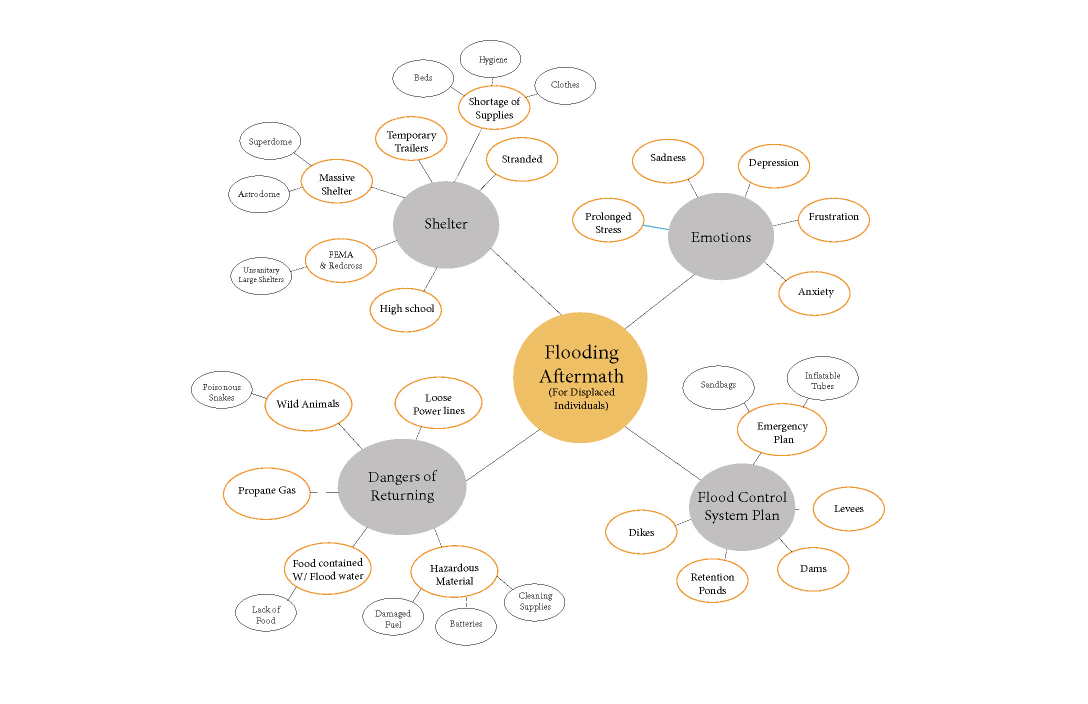
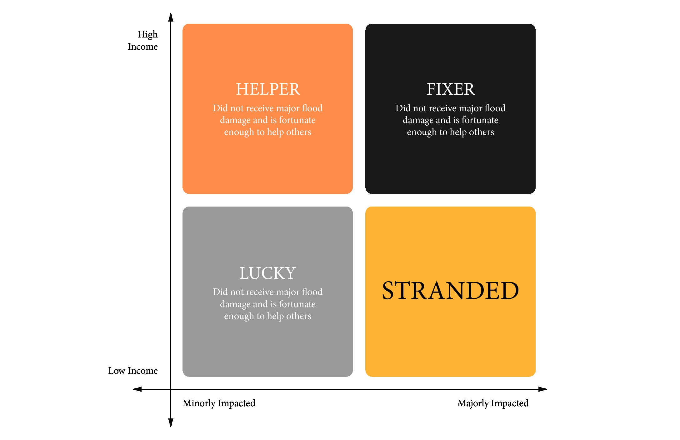
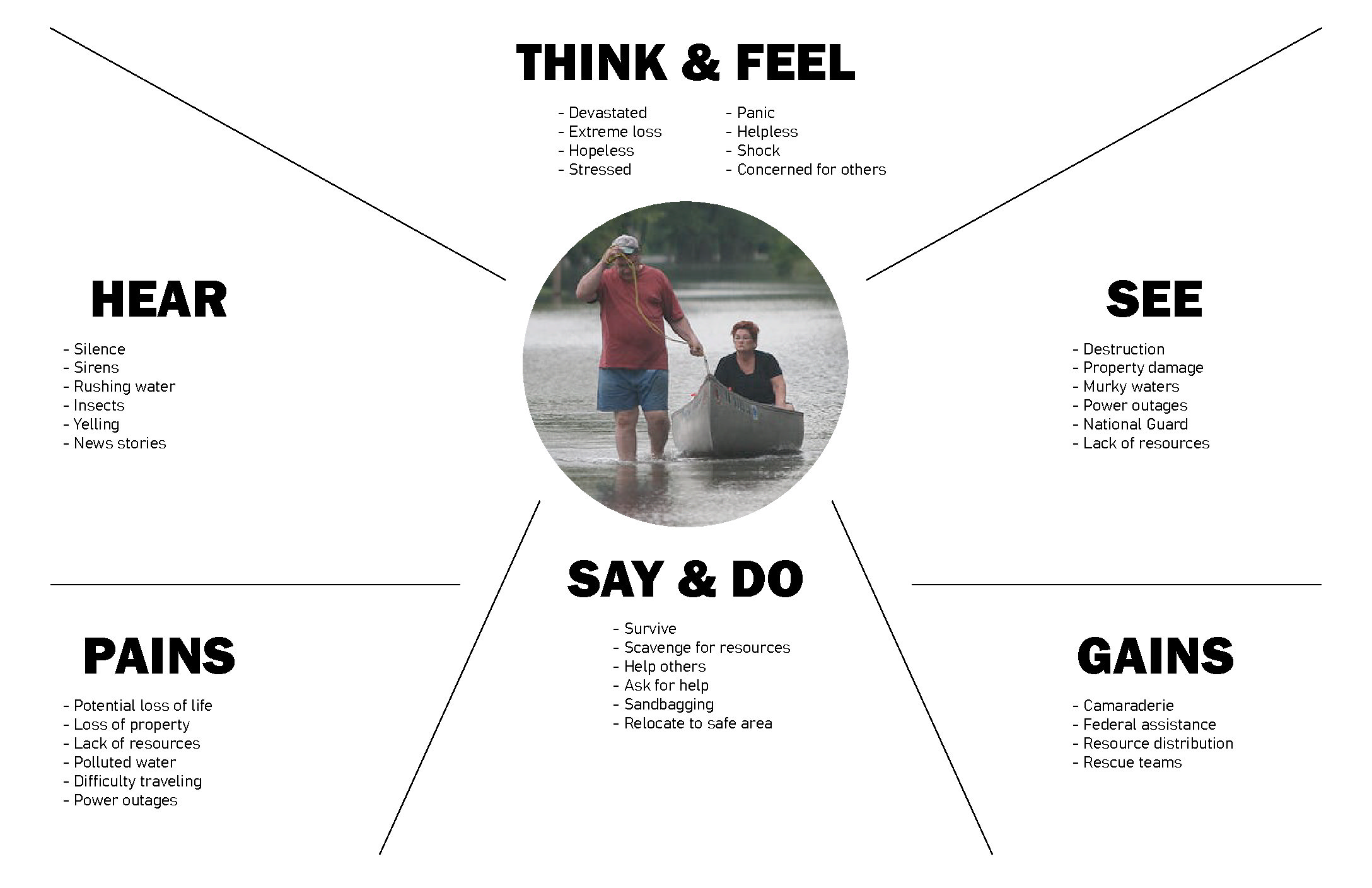
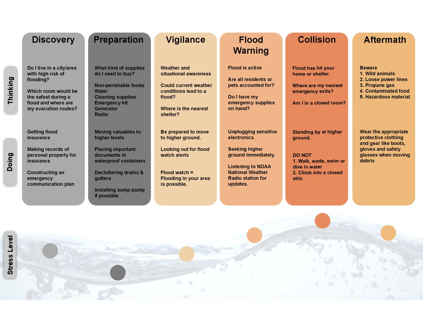
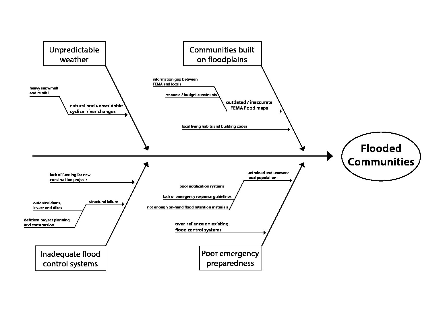
The intent of this project is to design for people displaced by flooding. Our focus is primarily on Midwestern flood events and the communities affected by them. These local populations were easily accessible for primary research. Comprehensive research was conducted, then synthesized using a variety of methods.
Most people don’t know where their home is in relation to flood patterns, and where they can safely seek refuge.
How might we facilitate emergency preparedness and wayfinding for people affected by flood events?


Definition
Research helped us empathize with those impacted by flooding, and gave us key insights that guided the direction of the project.
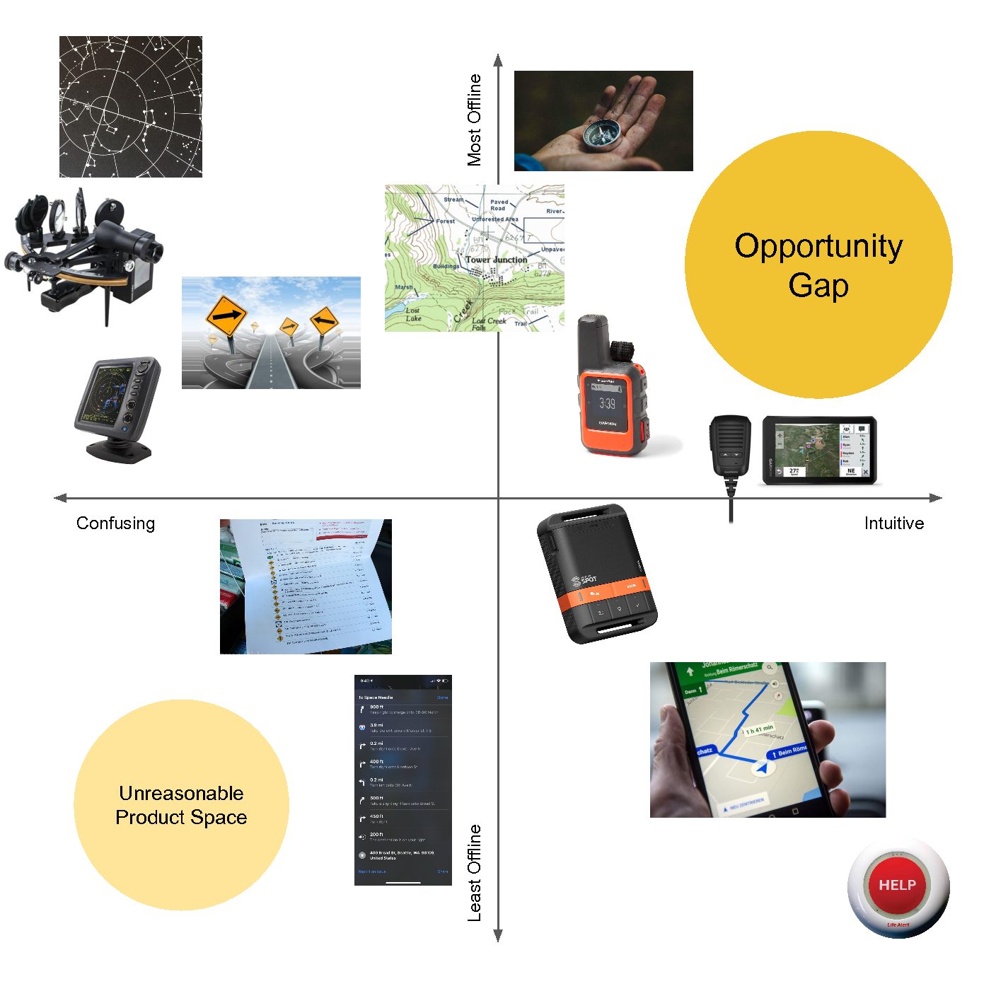
We found that there is an opportunity for an intuitive, fully offline product that aids in emergency preparedness and navigation.
Development
Concept Generation
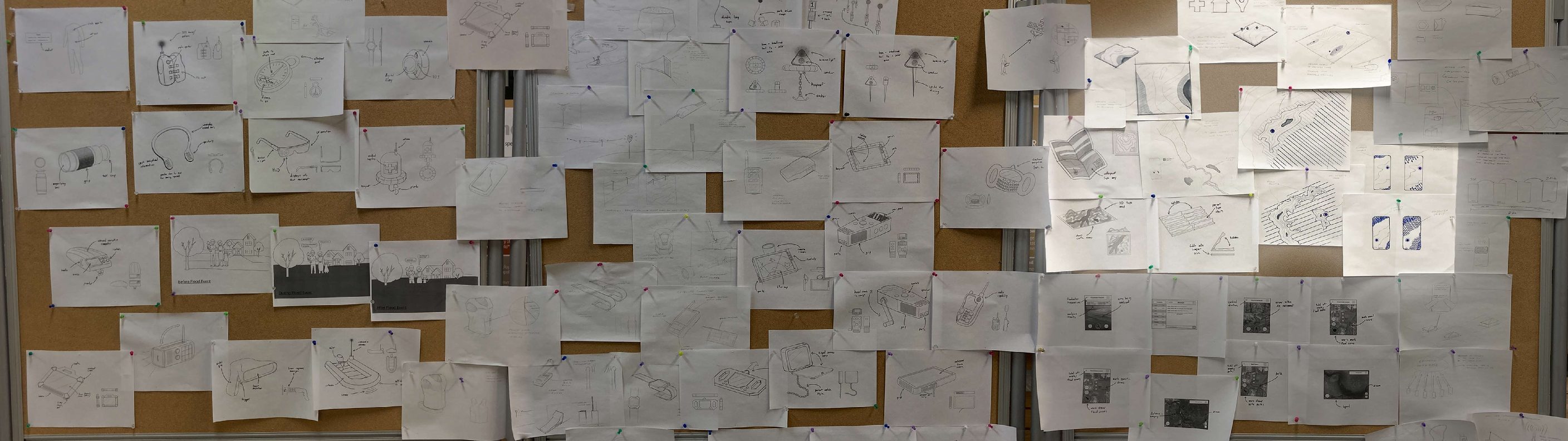
Ideation
100 concepts were generated. The ten best concepts were developed further, then rated by how they fit each design criteria.
The results: a physical topographic product came out on top.
Refined sketches


Prototypes and final model


Eagle Eye
Emergency preparation and offline navigation.


Emergency preparation
Long before disaster strikes, educational tools help people prepare. Emergency preparation for tornadoes and fires has already made its way into school curriculums and family plans.
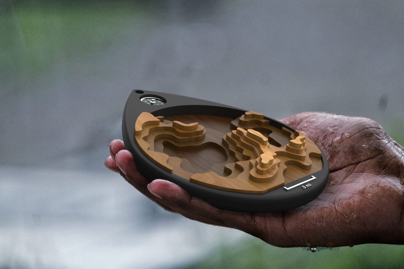
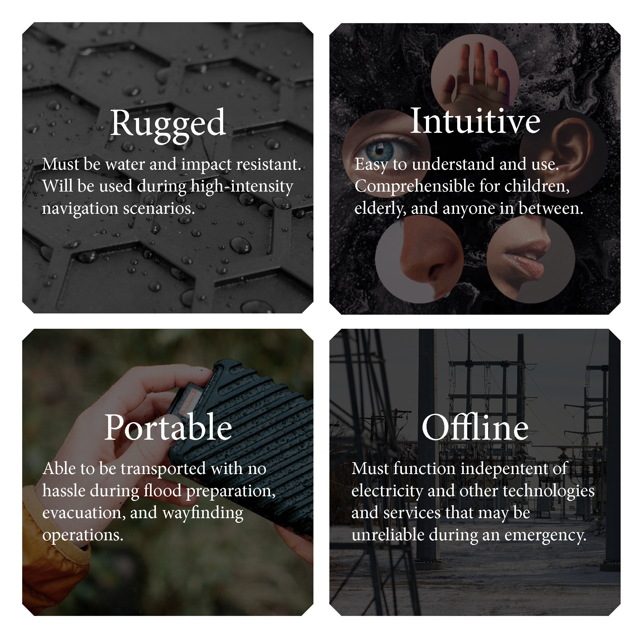
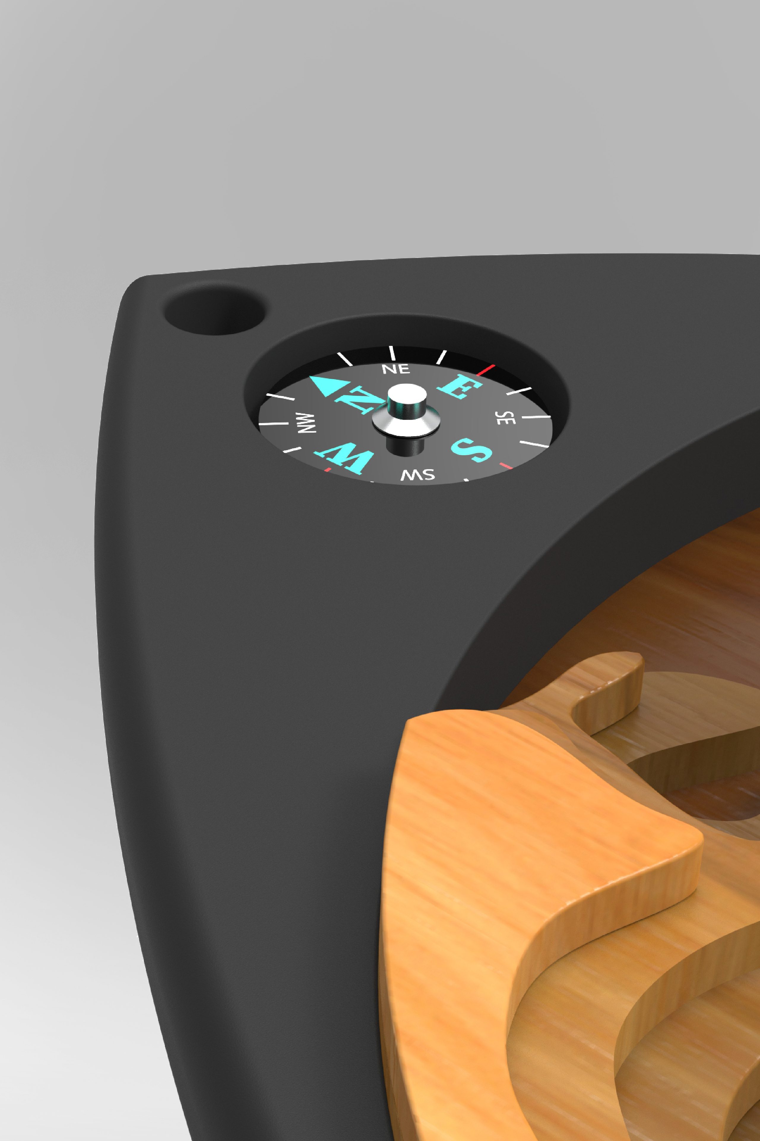
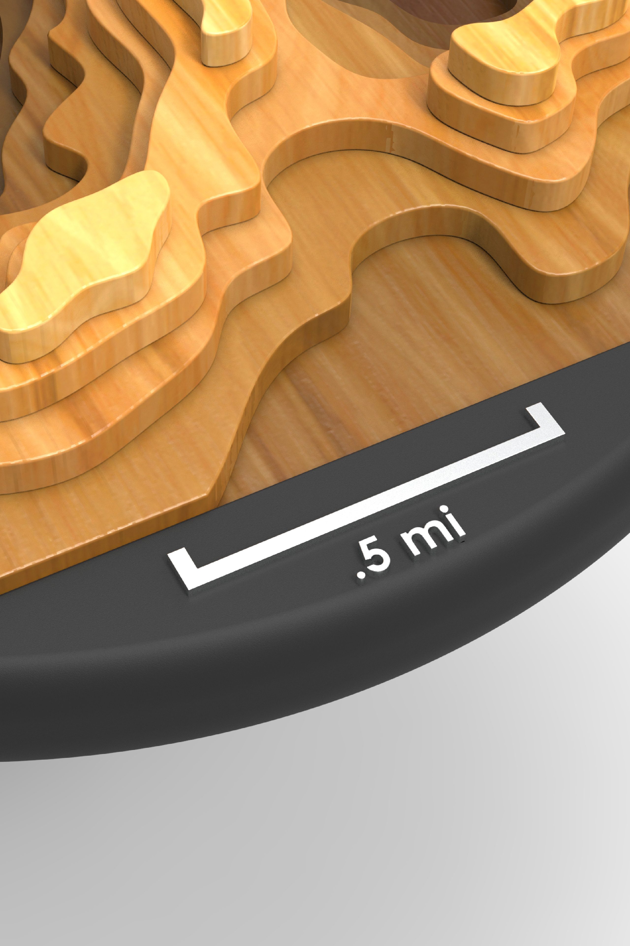
The Eagle Eye is an interactive tool for flood preparation, helping people understand the geography and flood patterns of their local area. Using the topography of its surface, the path of the flood can be tracked from lower to higher elevation. Important places, such as the home, school, workplace, grocery store, and safe points are chosen by the user and shown on the surface of the Eagle Eye. Its intuitive physical interface allows it to be used by those of all ages.
Offline navigation during emergency
During the event of a flood the Eagle Eye functions as an offline navigational tool. The user holds or clips on the device during their journey to safety.
As the user journeys, they reference the user-selected landmarks on the surface of their Eagle Eye, comparing them to the landmarks in the world around them. Using the integrated north-facing pointer, compass, scale, and topographic levels, the user safely navigates on high ground. In this way they avoid dangerous floodwater and damaged infrastructure.
Eagle’s Nest App
Through the Eagle’s Nest app users can painlessly customize and acquire their own Eagle Eye. Each product is individualized based on a user’s home location, local landmarks, and topography.